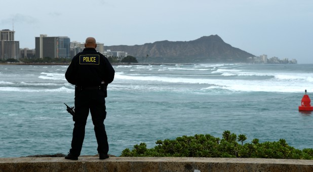
Torrential Rain, Howling Winds Lash Hawaii as Hurricane Lane Approaches
Hurricane Lane spun through the Pacific toward Hawaii on Friday, losing power and slowing as it weakened to a Category 2 storm that brought raging surf, torrential rain and catastrophic flooding to the Big Island.
It is forecast to pass to the west of the islands over the weekend, with hurricane conditions expected from Friday night over Maui and Oahu, the U.S. state’s most populous island, the National Weather Service said. Further north, a hurricane watch was in effect for Kauai.
“If you’re in Hawaii, it’s critical that you heed the warnings of local officials and stay aware of your surroundings,” the head of the Federal Emergency Management Agency (FEMA), Brock Long, wrote on Twitter.
More than 2 feet (60 cm) of rain had fallen on a couple of areas on the windward side of the Big Island, the weather service said, where peak gusts of up to 67 miles (108 km) per hour were recorded.
Flash floods and landslides closed some roads. Hawaii Governor David Ige said it was a very dangerous situation and urged people to avoid unnecessary travel.
Evacuations were underway on parts of Molokai and Maui islands, and some social media users reported power outages.
A fast-growing wildfire on Maui forced the evacuation of local residents and others who had sought safety at a storm shelter in Lahaina, where no rain was falling, officials said. One woman was hospitalized with burn injuries. The cause of the blaze was not immediately known.
Australian tourist Nicole Paterson, 27, said her birthday plans were scuppered by the storm. She has been planning to snorkel with turtles on Oahu’s North Shore on Friday, and visit the Disney resort in Ko Olina, but both were shut.
‘TAKE THE STORM SERIOUSLY’
While Lane was downgraded on Friday to Category 2 on the Saffir-Simpson scale, it still packed maximum sustained winds of 105 mph (170 kph), the service said. A Category 5 is the strongest hurricane on the Saffir-Simpson scale.
As of 8 a.m. Hawaii time (2 p.m. EDT/1800 GMT), Lane was moving north at just 2 mph (3 kph) and was about 170 miles (274 km) south of state capital Honolulu, the weather service said. It was forecast to turn west on Saturday, lose some of its punch and move more quickly.
The latest predictions from the weather service’s National Hurricane Center showed the eye of the storm glancing past Maui and several other islands on Friday on its way toward Oahu.
“We’re telling everybody to take the storm seriously, make your final preparations, and be prepared to ride out what is going to be a prolonged rain event,” said Andrew Pereira, communications director for Honolulu.
In addition to “life-threatening and damaging surf,” the weather service has warned that storm surges could raise water levels 3 to 5 feet (1 to 1.5 meters) above normal along the western shores of the Big Island and that extreme rainfall could mean numerous evacuations and rescues.
Governor Ige has urged residents to set aside a 14-day supply of water, food and medicine. All public schools, University of Hawaii campuses and nonessential government offices on the islands of Oahu and Kauai were closed at least through Friday.
The Coast Guard had ordered all harbors to close to incoming vessels and the Navy moved most of its fleet out of Pearl Harbor, where ships could provide aid after the storm.
Oil company Par Pacific Holdings Inc said it had shut its 93,500 barrel-per-day refinery in Kapolei.
In the event of outages, Hawaii’s power company, Hawaiian Electric Co, will largely be in charge of restoring power, FEMA’s Long told reporters, adding that the company is well prepared to fix any problems to the energy grid.
The federal government will be responsible for getting equipment and teams from the continental United States to locations where they are needed, he said.
“We need to set the expectations that the power could go off for quite some time, and the infrastructure’s going to be heavily impacted,” said Long. {eoa}
© 2018 Thomson Reuters. All rights reserved.


